Crisp Morning Sun Gives Way to Late-Day Alberta Clipper
A Chilly Start to Meteorological Spring
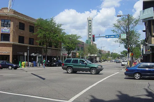
As Minneapolis wakes up this Sunday, March 1, 2026, the arrival of meteorological spring feels more like a deep winter encore. The morning hours will feature deceptive blue skies and bright sunshine, but residents should not let the light fool them. Temperatures are starting in the low teens, making for a bone-chilling start to the day. While the sun remains a constant companion through the early afternoon, a fast-moving weather system is already making its way toward the Twin Cities, promising to transform a serene Sunday into a snowy and windy evening.
Morning and Midday: The Calm Before the Storm
The first half of the day will be the best time for any outdoor errands or activities. Expect the following conditions through the early afternoon hours:
- Morning: Clear and sunny with a starting temperature near 10°F. Wind chills will likely dip into the sub-zero range, so heavy coats, scarves, and gloves are essential for anyone heading outdoors.
- Afternoon Highs: The mercury will struggle to climb despite the sunshine, eventually peaking at a high of roughly 24°F to 26°F by mid-afternoon.
- Wind: West-northwest winds will remain relatively manageable at about 9 to 12 mph during the day, though they will begin to shift and intensify as the atmospheric pressure drops later this evening.
Evening Outlook: The Alberta Clipper Arrives
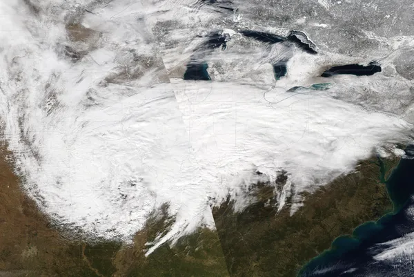
By late Sunday afternoon, cloud cover will thicken rapidly as an Alberta Clipper system descends from Canada. This fast-moving storm is expected to bring widespread light snow to the metro area starting between 4:00 PM and 6:00 PM. While the Twin Cities are not currently in the direct path of the heaviest snow bands, the metro is looking at a fresh coating of 1 to 2 inches by midnight. Visibility will drop significantly during the evening as the snow arrival coincides with increasing wind gusts from the northwest.
Winter Weather Advisory and Safety Notices
The National Weather Service has issued a Winter Weather Advisory for the Twin Cities and the surrounding metro counties. While areas in south-central Minnesota are facing more severe Blizzard Warnings, local residents should prepare for the following impacts:
- Blowing Snow: Northwest wind gusts could reach up to 40 mph by late evening. This will cause drifting on east-west roads and create intermittent whiteout conditions in open areas.
- Flash Freeze: As the precipitation ends late tonight, temperatures will plummet back into the teens. Any slush or melted snow on the roadways will freeze rapidly, creating hazardous "black ice" conditions for the Monday morning commute.
- Travel Impact: Major transit hubs, including MSP International Airport, may experience de-icing delays starting this evening. If you must travel tonight, ensure your vehicle is equipped with an emergency kit and allow for double the usual travel time.
Stay tuned to minneapolis.news for real-time updates as this system moves through the region. Bundle up and stay safe on the roads as we navigate the first storm of the new month.
Morning Mist Gives Way to a Record-Chasing March Thaw

Minneapolis man gets 57 months for attempted juror bribery tied to Feeding Our Future trial

Minneapolis council members challenge MPD response to ICE actions as federal enforcement surge strains city limits